Project Outputs
The outcome of this project is the Waterway Corridors Planning Methodology. You can download and read the report under Key Documents on this page.
 Waterway Corridors
Waterway corridors provide an opportunity for active lifestyles within natural environments, vital for mental and physical wellbeing.
They can provide opportunities for walking tracks, bike paths and recreational trails - away from the dangers of traffic and the noise of everyday life. Corridors help to create unique opportunities to deliver infrastructure efficiently through linear corridors, establish buffers between urban areas and natural hazards like flooding and bushfire, whilst preserving and enhancing biodiversity, connecting fragmented remnant habitat, and maximizing ecological processes and connectivity.
Why plan waterway corridors?
Much like the foreshore vegetation along the Esplanade, waterway corridors can provide connected, vibrant, and natural greenspaces that link habitat, parks and places within an urban environment.
Waterway corridors provide:
- Active and healthy residents who benefit from living in proximity to the natural environment and active transport options.
- A network of open space, walking trails, bike paths and roads that make good use of land constrained by natural hazards.
- Large tracts of good quality vegetation that provide a diverse and connected set of habitats.
- Healthy waterways and wildlife corridors.
- Cost effient infrastructure delivery and ongoing maintenance.
Good examples of waterway corridors
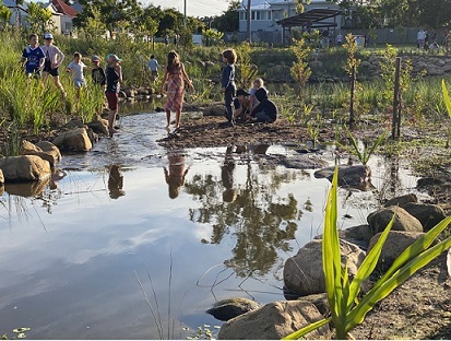
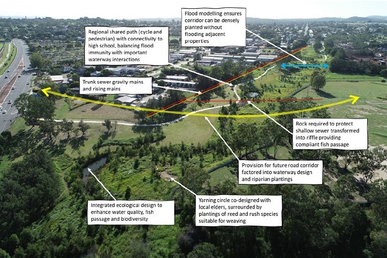
The waterway corridor below at Small Creek, Ipswich, set out to:
- Revitalise the creek which runs through the park.
- Enhance the environment with healthy waterways, more trees, wildlife corridors and natural spaces.
- Increase recreational and social opportunities for residents and visitors.
- Enhance connectivity, accessibility and active transport options.

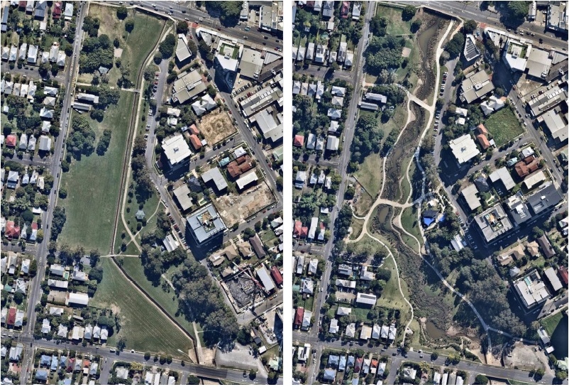
The waterway corridor pictured below shows the revitalisation of Hanlon Park, Brisbane City Council.

How can we create and plan for waterway corridors in new urban areas?
The Waterway Corridors Planning Methodology document provides the guidance to for waterway corridors and will be integrated into various sections of the planning scheme to provide guidance for development.
This will include, but is not limited to:
- zoning / quarantining of waterways corridor areas;
- guidance for masterplanning future growth areas;
- guidance for landscaping;
- vegetation protection within waterway corridors;
- guiadance for open space provision, role and function, including the buffering of residential areas from potential bushfire hazard; and
- information Council may require for a development application.
The Waterway Corridors Planning Methodology was used recently to prepare a master plan for the Bunya Creek, south of Hervey Bay.
Building Better Neighbourhoods
The Waterway Corridors Planning Methodology was identified as a key project by the Building Better Neighbourhoods Roadmap.
Related projects include:

